The Escalating Threat of Wildfires and the Need for Swift Detection
Wildfires pose an increasingly severe threat across continents, exacerbated by rising temperatures and prolonged droughts. Regions in Europe, Canada, and beyond are grappling with more frequent and intense blazes. The critical factor in mitigating their destructive impact is early detection and rapid response. Often, these fires originate from seemingly minor incidents, such as a discarded cigarette or a spark from a campfire, quickly escalating into major infernos if not addressed promptly.
Traditional methods for spotting nascent fires, particularly in remote or inaccessible areas, face significant challenges. However, technological advancements are offering new solutions. Before visible smoke or flames can be observed by ground teams, satellite systems are now capable of issuing early warnings, providing a crucial head start for emergency services.
Leveraging Satellite Data for Enhanced Wildfire Monitoring
A wealth of satellite data, such as that provided by NASA's Fire Information for Resource Management System (FIRMS), is publicly available, offering global insights into fire hotspots. This data is typically accessible within three hours of satellite observation, with some regions, like the US and Canada, benefiting from real-time availability. Similarly, the European Forest Fire Information System (EFFIS) supplies free data for Europe, the Middle East, and North Africa, integrating information from NASA, Copernicus, and the European Earth observation program.
Despite the abundance of free data, specialized companies are developing sophisticated models to improve wildfire detection. Munich-based startup OroraTech has built a business around this, combining satellite data, artificial intelligence (AI), and rapid service delivery to provide real-time wildfire monitoring from space.
Addressing Data Gaps with Proprietary Satellite Technology
Thomas Grübler, Chief Strategy Officer at OroraTech, highlights a significant limitation of conventional satellite systems: they often capture images only at specific times of the day, such as mornings or noons. This creates an 'afternoon gap,' a critical period when wildfires frequently ignite and spread. OroraTech addresses this by deploying its own network of satellites designed to fill these observational gaps.
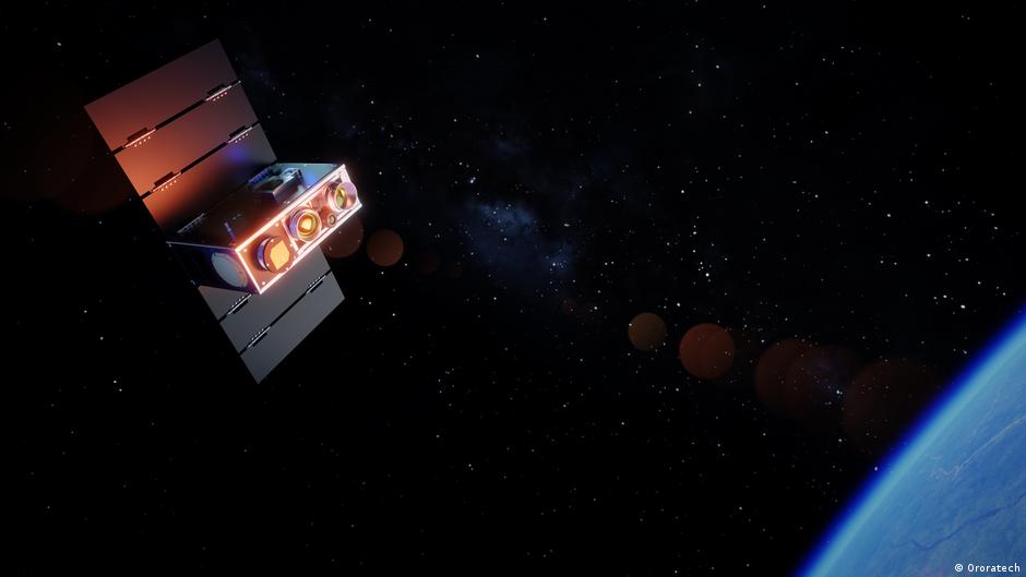
Furthermore, the resolution of many conventional satellite cameras is not optimized for detecting small fires, meaning crucial data might reach firefighters with a delay, allowing fires to spread unchecked. OroraTech's solution involves miniaturized cameras equipped with thermal infrared sensors. Launched into orbit starting in spring 2022, these shoebox-sized satellites can detect subtle temperature differences, enabling them to identify heat sources even at night or through smoke. While dense cloud cover can still impede observations, the compact design makes these satellites more cost-effective and energy-efficient than larger counterparts.
The Role of AI in Transforming Data into Actionable Insights
OroraTech asserts that it currently operates more thermal imaging satellites than any other entity globally. Their ambitious goal is to achieve a daily scanning frequency that ensures every point on Earth is monitored every 15 minutes by 2028. However, simply detecting fire sources is just the first step. Grübler emphasizes that the company's core mission is to make this data 'actionable.'
To achieve this, OroraTech employs AI to analyze not only its own satellite data but also information from other sources, including ESA and NASA. This comprehensive analysis allows customers to receive alerts about fire sources within minutes, coupled with continuous updates on potential fire progression and assessments of their consequences. This real-time data is instrumental in managing wildfires effectively, guiding where and how firefighters should respond.
Global Impact and Future Applications
OroraTech serves a diverse clientele across 25 countries, including government agencies, fire departments, forestry companies, infrastructure and energy providers, insurance companies, and environmental organizations. The company also supplies data from its satellites to organizations like ESA and NASA. A notable collaboration with ESA involves the Greek government, for whom a specialized system, comprising four satellites, a ground station in Greece, and OroraTech's Wildfire Solution platform, was developed. This system provides continuous, real-time wildfire detection data across Greece, proving particularly valuable in countries where fires can develop and spread with extreme rapidity.
Currently, OroraTech monitors an astounding 407 million hectares of forest worldwide, an area comparable in size to the entire European Union, covering regions in Brazil, Chile, the US, Canada, and Australia. Grübler notes the unexpected shift of this technology from a niche application to mainstream importance, predicting continued market growth due to the increasing incidence of fires.
Beyond wildfire detection, the thermal satellite technology holds promise for numerous other applications. The ability to measure heat emissions opens doors for agricultural insights, such as monitoring water evaporation from fields, identifying urban heat islands, detecting oil spills at sea, and even applications in the defense sector, like tracking ships that have deactivated their transponders. Grübler anticipates that within five years, entirely new use cases for this technology will emerge, expanding its impact far beyond current expectations.